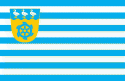
Anija Parish (Anija vald)
 |
 |
The parish has a population of 6274 and covers an area of 532.91 km².
The administrative centre of the municipality is Kehra. The municipality also has an office in the borough of Aegviidu.
Anija Parish is bordered by Kuusalu, Jõelähtme, Raasiku, Kose parishes in Harju County, Järva parish in Järva County and Tapa Parish in Lääne-Viru County.
Anija Village (Hangægus) was first mentioned in the Danish Census Book in 1241.
Anija Manor, the namesake of Anija Parish, was first mentioned in 1482.
Anija Parish was first created in the 19th century as part of the bigger, now arhaic Harju-Jaani Parish.
In 1939, Anija Parish ceded Aavere, Pillapalu and gained Alavere Parish, Paasiku, and parts of Kiviloo.
In 1945, Anija, Kehra and Pikva Rural Councils were created on the lands of Anija Parish.
In 1950, Anija Parish was abolished, effectively being replaced by the three rural councils.
Map - Anija Parish (Anija vald)
Map


Country - Estonia
 |
 |
| Flag of Estonia | |
The land of what is now modern Estonia has been inhabited by Homo sapiens since at least 9,000 BC. The medieval indigenous population of Estonia was one of the last pagan civilisations in Europe to adopt Christianity following the Papal-sanctioned Livonian Crusade in the 13th century. After centuries of successive rule by the Teutonic Order, Denmark, Sweden, and the Russian Empire, a distinct Estonian national identity began to emerge in the mid-19th century. This culminated in the 24 February 1918 Estonian Declaration of Independence from the then warring Russian and German Empires. Democratic throughout most of the interwar period, Estonia declared neutrality at the outbreak of World War II, but the country was repeatedly contested, invaded and occupied, first by the Soviet Union in 1940, then by Nazi Germany in 1941, and was ultimately reoccupied in 1944 by, and annexed into, the USSR as an administrative subunit (Estonian SSR). Throughout the 1944–1991 Soviet occupation, Estonia's de jure state continuity was preserved by diplomatic representatives and the government-in-exile. Following the bloodless Estonian "Singing Revolution" of 1988–1990, the nation's de facto independence from the Soviet Union was restored on 20 August 1991.
Currency / Language
| ISO | Currency | Symbol | Significant figures |
|---|---|---|---|
| EUR | Euro | € | 2 |
| ISO | Language |
|---|---|
| ET | Estonian language |
| RU | Russian language |